
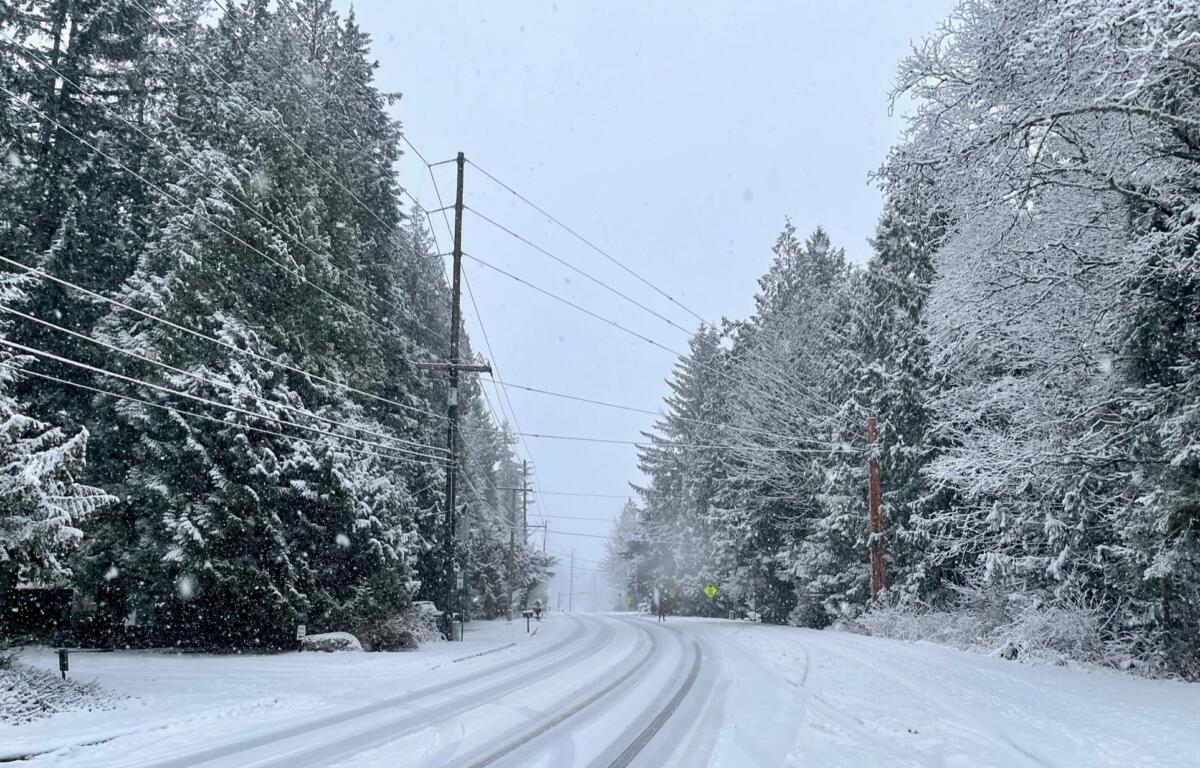

BELLINGHAM, WA – (KGMI.com) This weekend brings colder, windier and snowier weather to Whatcom County.
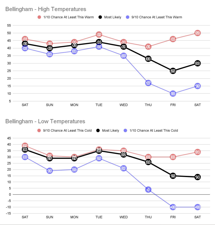
According to the National Weather Service in Seattle, temperatures are going to dip steadily over the next few days, potentially reaching just 14 degrees by next Saturday.
Low temperatures will likely reach below freezing after predicted wind chill by the early hours of Sunday for western Whatcom.
The NWS also says that western Whatcom County should expect southerly winds with gusts up to 45 mph starting Friday evening and tapering off through Saturday morning.
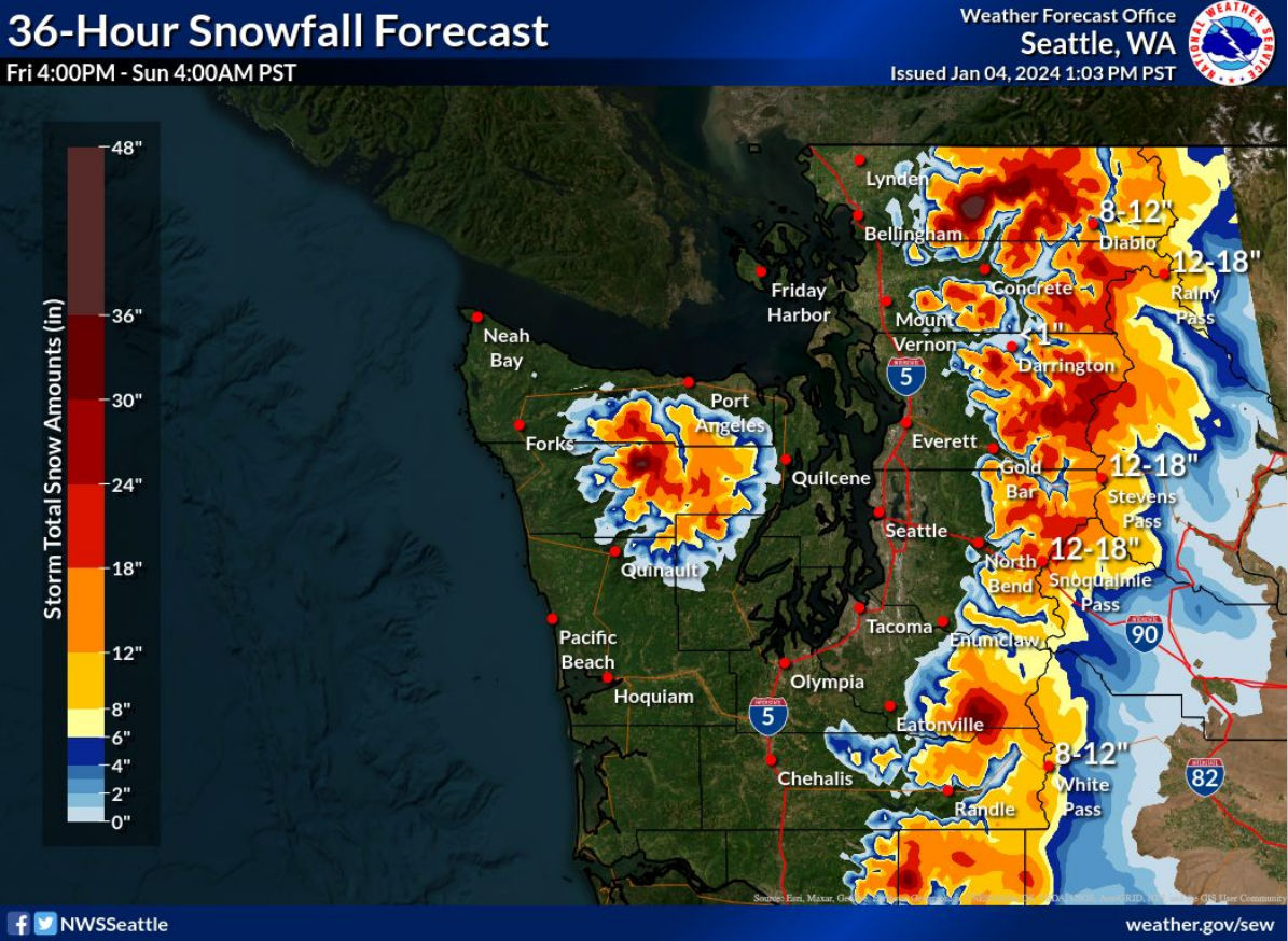
And snow is predicted to fall in the county as low as 1500 feet elevation this weekend, with a potential 48 inches falling on Mt. Baker.
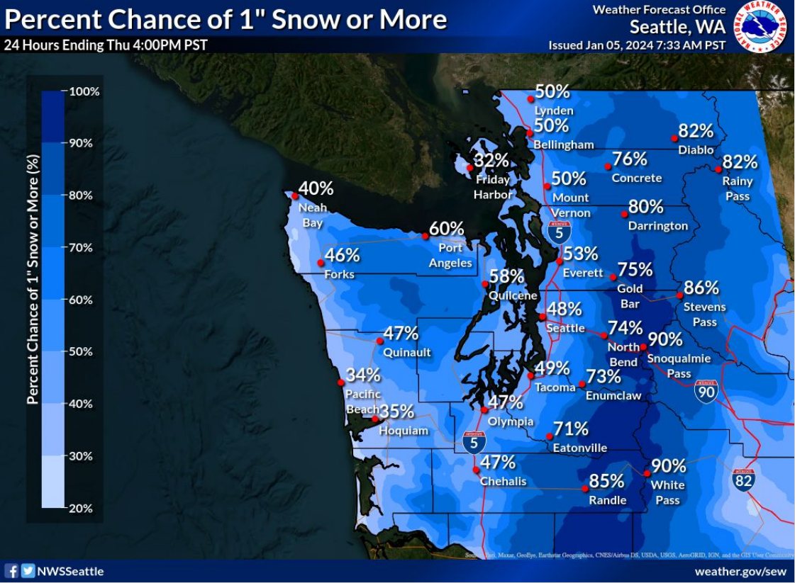
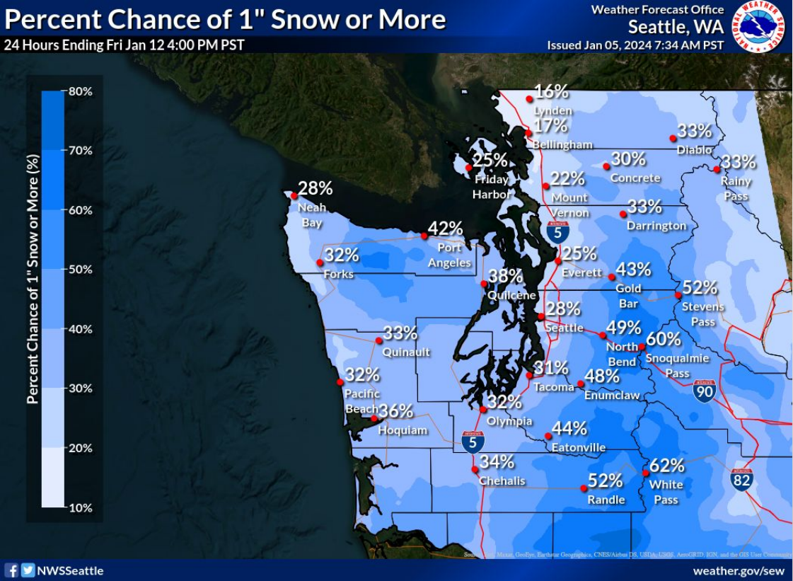
Snow could reach the western part of the county later next week, with a 50% chance of at least one inch predicted for Bellingham by next Friday morning.
Here is the snow prediction for western Washington ahead of this coming weekend:
Below are the graphics depicting next week’s snowfall forecast:
Here are the predicted temperatures for this next week before accounting for wind chill: